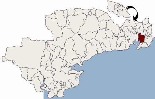
Placename :
Kilmacleague
In Irish : Cill Mhic Liag
Administrative Unit : Parish
 Pronunciation Audio File
Administrative Details:
Description:
The parish is called after the townland on which the church stood - the townland and church deriving their name in turn from the 7th century founder of the latter. Only insignificant remains of the church survive; these are rather picturesquely situated on the extreme point of a fertile headland which juts out into that portion of Tramore Bay, known as “The Back Strand.� Close to the church lies a great stone font or laver of rude workmanship and portion of a second and much smaller, but otherwise similar, vessel. Several well defined mounds, with traces of many earthen buildings and enclosures, immediately to the north of the ruin, tell of a former extensive settlement.
Old Irish Typeface
Parish Location Map:

Townlands:
Ballinvella,
Ballygarran,
Ballyloughbeg,
Ballynamoyntragh,
Ballyshoneen,
Keiloge,
Kilmacleague East,
Kilmacleague West,
Orchardstown,
Related Resources
To view full-text articles you will need to ensure you have Adobe Acrobat Reader loaded on your PC.
Online Books and Journals
Full-text monographs, journals, and articles of Waterford Interest include useful resources for Affane:
Placenames Database of Ireland
This is a comprehensive management system for official data, archival records and placenames. The public website is primarily aimed at journalists and translators, students and teachers, historians and researchers in genealogy. It is a public resource for Irish people at home and abroad.
|