Placename :
Faithlegg
In Irish : Fáithling
Administrative Unit : Parish
 Pronunciation Audio File
Administrative Details:
Description:
In the Down Survey map (Record Office, Dublin) this is represented by a single townland which gives name to the parish. The two additional townlands therefore must have been formed out of the first within the past 250 years. The ruins of the ancient church are in an excellent state of preservation; they consist of nave and chancel connected by a pointed chancel arch of wrought red sandstone. The west doorway, also of red sandstone, and in harmony (architecturally) with the chancel arch is somewhat elaborately moulded. Within the nave is a rather remarkable holy water stoup or baptismal font.
Old Irish Typeface
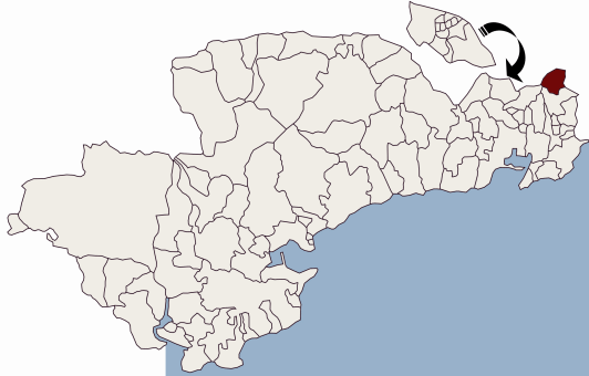
Parish Location Map:
Townlands:
Cheekpoint,
Coolbunnia,
Faithlegg,
Kilcullen Lower,
Kilcullen Upper,
Related Resources
To view full-text articles you will need to ensure you have Adobe Acrobat Reader loaded on your PC.
Online Books and Journals
Full-text monographs, journals, and articles of Waterford Interest include useful resources for Affane:
Placenames Database of Ireland
This is a comprehensive management system for official data, archival records and placenames. The public website is primarily aimed at journalists and translators, students and teachers, historians and researchers in genealogy. It is a public resource for Irish people at home and abroad.
|